Location
Moldovska street is located in Kyiv’s Shevchenkivsky district. It starts at Dovzhenko street and cuts off near Pushkin Park. It stretches for about 1200 meters within the limits of the block.
Moldovska street is located in Kyiv’s Shevchenkivsky district. It starts at Dovzhenko street and cuts off near Pushkin Park. It stretches for about 1200 meters within the limits of the block.
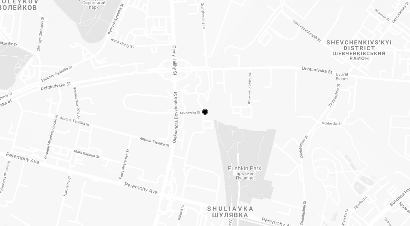
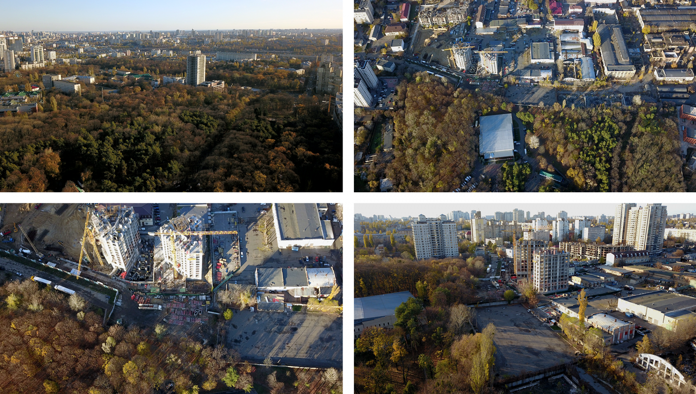
Poetica Residential Complex is being constructed along one side of Moldovska street, while Pushkin Park is adjacent to its other side. The residential complex is located in the cultural, scientific, and recreational context. Next to it, there is the Kyiv Zoo, academic buildings of the Bohomolets University, Kyiv National Economic University and Kyiv Technical Institute, as well as Dovzhenko Film Studios. A little further up—Unit City Innovation Park.
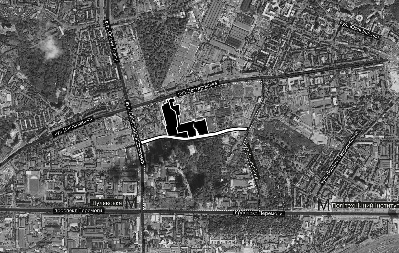
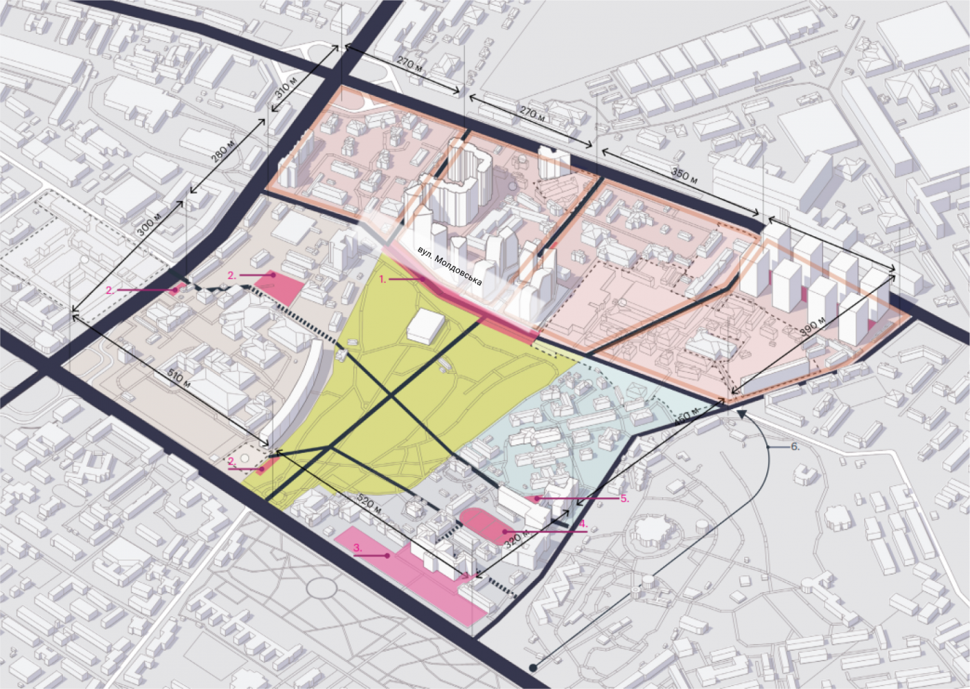
We conducted a spatial analysis of the neighborhood to be able to create the concept of the convenient street and to add community features that are lacking in the district. We focused on the 300-ha square that is within walking distance from Poetica Residential Complex.
The area under investigation covers the territory between Shuliavska and Politeknichny Institute subway stations, goes along Dehtiarivska street, partially includes some blocks of the Lukianivka micro district.
In the XVIII century, when city limits came up close to Shuliavka, this area was used to grow fruit. The city continued to expand. As the orchards were not producing sufficient harvests, they transformed into a park. A lavish celebration took place here in 1899 in honor of Pushkin’s 100th birthday. Since then, the park and one of Kyiv’s central streets have been named after him.
In the middle of the ХІХ century, the area became a state-owned property and active construction followed. Industrial enterprises and the Technical Institute were built along the Brest-Lytovske Chaussee (Peremohy Prospect). Blue-collar workers and the Technical Institute teachers were the first residents of this district.

In the times of industrialization, industrial development came to the northern part of the park that is adjacent to Moldovska street. As there was no systemic development, chaotic construction took over the area piece by piece. Since every enterprise existed independently, there was no need to tie parts of the neighborhood in with each other. Moldovska street ended up being blocked off and was never realized.
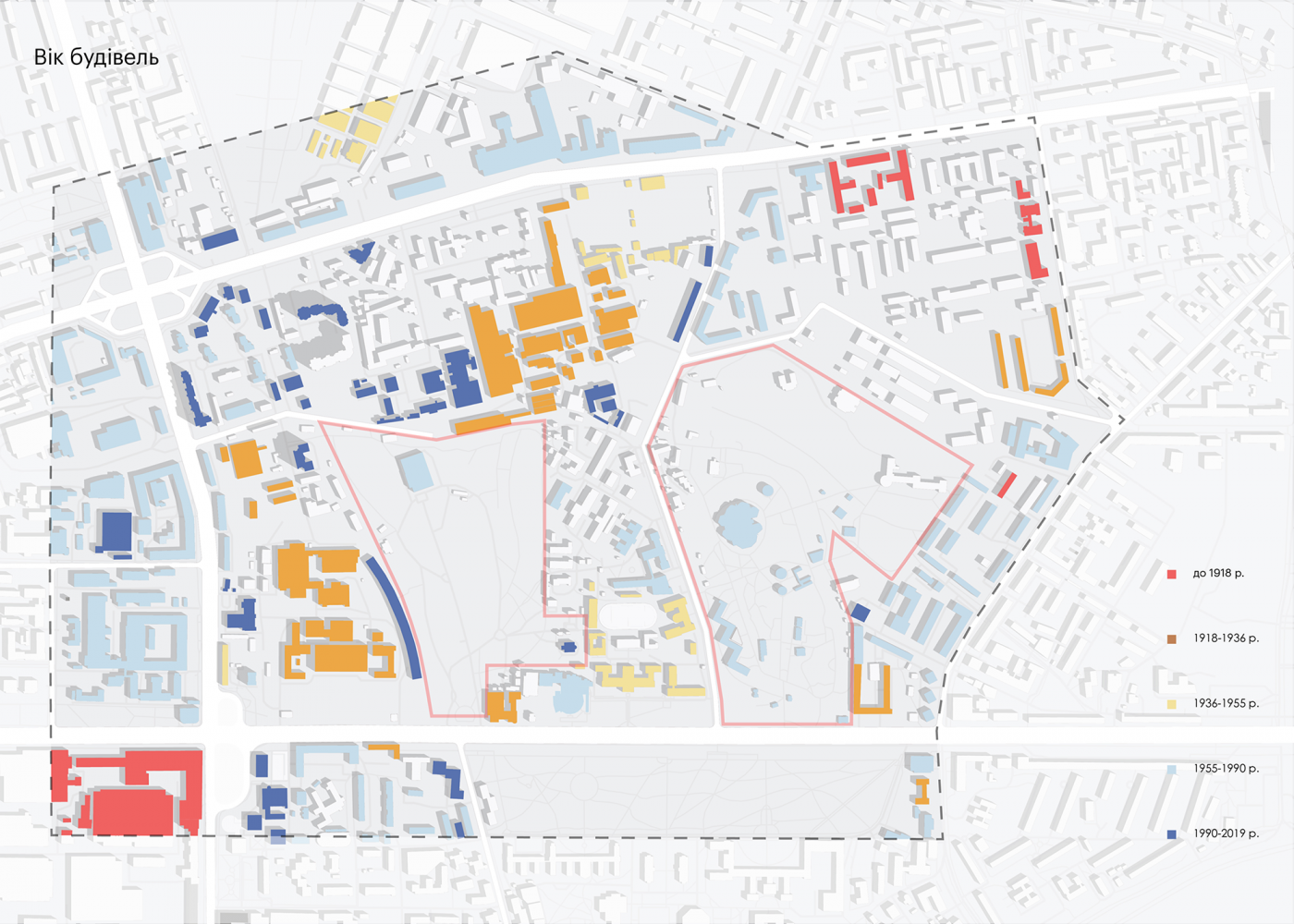
The establishments of the Soviet era have either closed or are only operating partially. Their buildings are rented out and their territories are not at all connected to one another—closed to the outside and chaotic inside. An office cluster emerged at the intersection of Dehtiarivska and Zoolohichna streets. Buildings of the medical university campus and the hospital continue to develop. All of the above, along with the residential zones’ inhabitants and the students, form the majority of the space users.
The neighborhood is changing rapidly, as new building complexes and institutions are being built, attempts are made to improve transportation and to rethink the design of the territory.
Soviet housing areas are equipped with children's playgrounds, sports facilities, and places for recreation. The courtyards in the newly constructed housing are closed off to the general public, which partially limits the use of the space.
The closed infrastructure of new housing and the territory of the former industrial zone are blocking the access to the park along its entire perimeter. The main entrance, accessible from Peremohy Prospect, is the only working entrance. The park has the potential to become the unifying public space for all users of the neighborhood.
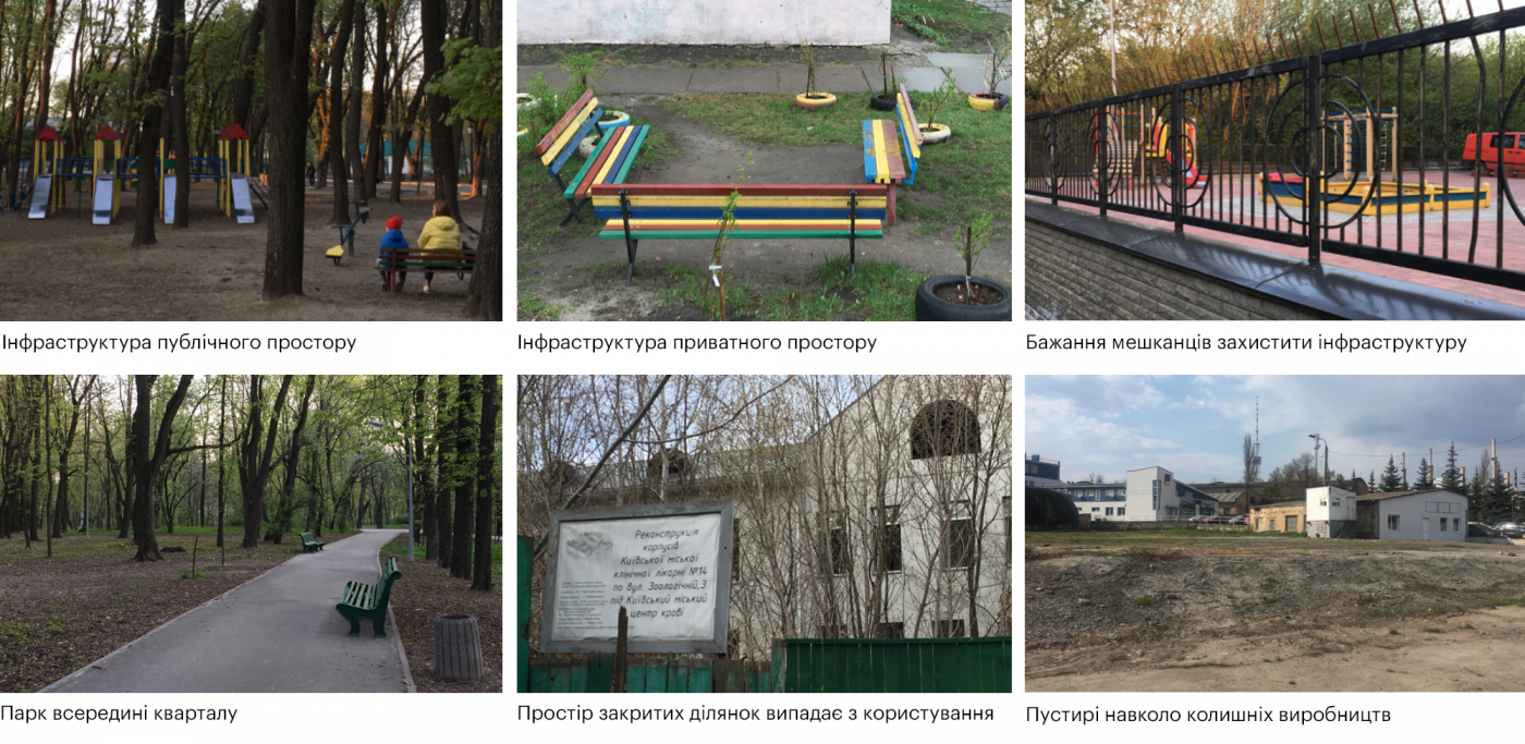
According to the development plan, the area is supposed to transform from industrial to residential within the next 5 years. The number of residents and office workers is going to increase sharply, which will create an additional burden on the area. It is important to plan the use of space as a whole, which will have a direct influence on the attractiveness of the area and the comfort of the residential district’s inhabitants.
In order to make the space comfortable and easy to use, it is important to look at the area as a whole and to organize the necessary connections
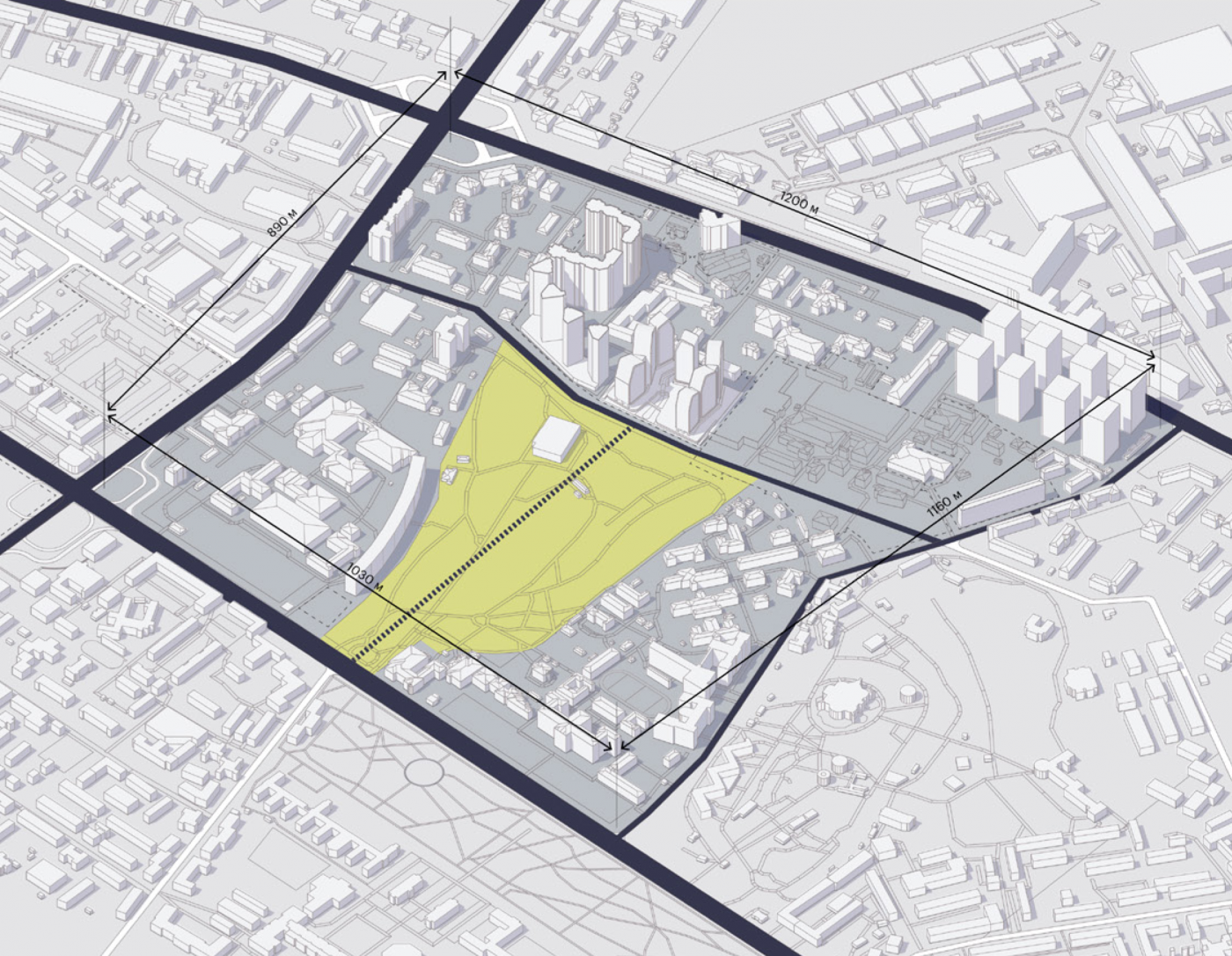
Right now, the neighborhood is a mega block of 1200 by 1200 meters located between the streets of Oleksandr Dovzhenko, Dehtiarivska, Zoolohichna, and Peremohy Prospect. It has no internal connection through its entire length of more than a kilometer. The inconvenient connections have led to decreased activity within the block.
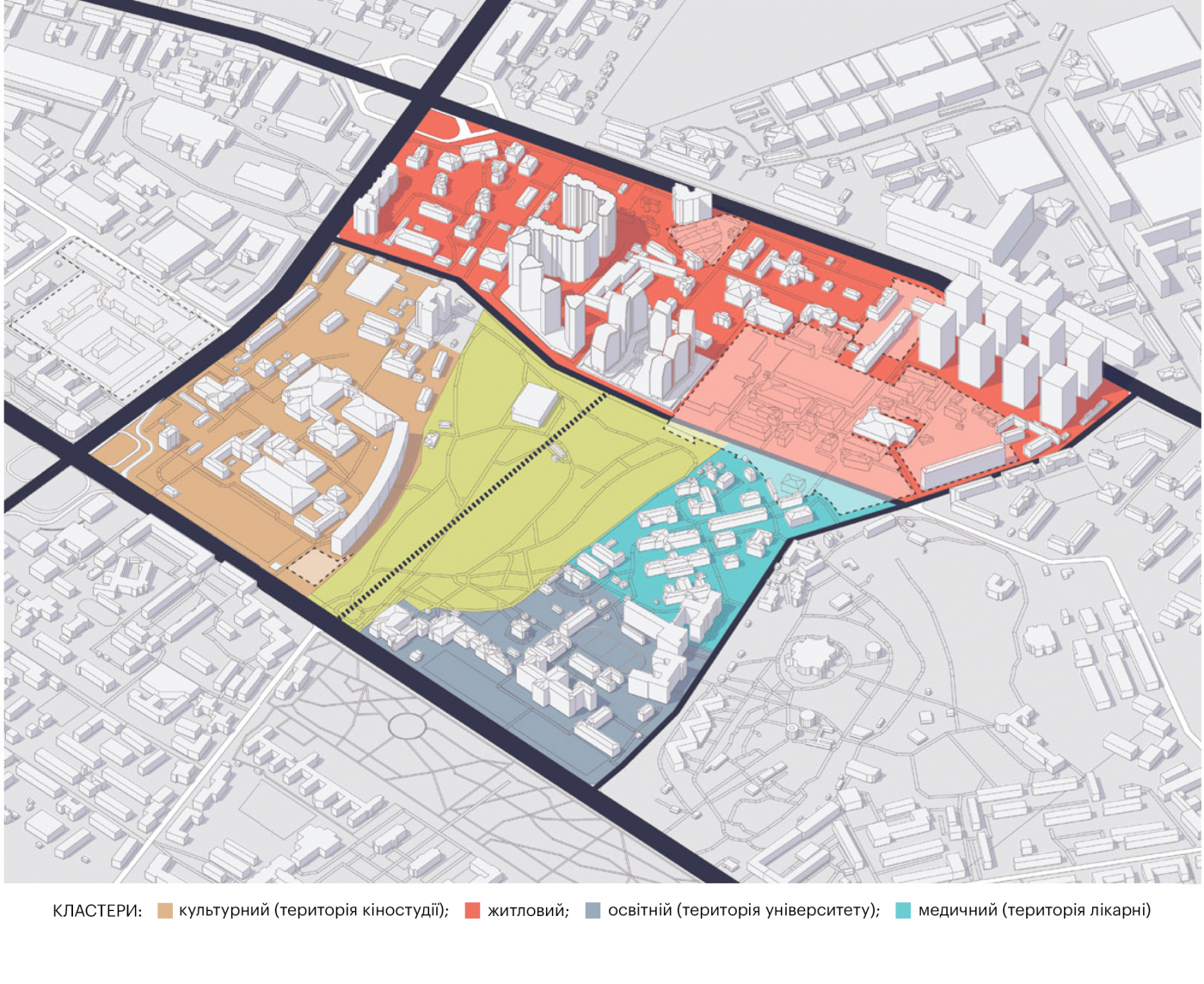
The new construction will attract many regular, as well as occasional users. The buildings around the park can be grouped into the following types of clusters: cultural, residential, educational, medical.
In every cluster, we define the main anchor points. In the residential cluster, the anchors are two residential complexes—Poetica and Creator City; in the cultural cluster—Dovzhenko Film Studios; in the educational—Bohomolets University; in medical—City Clinical Hospital #4, outpatient clinic, the Otolaryngology Institute, and the Respiratory Diseases Center. We organize the internal connections between them and create an easy access into the neighborhood.
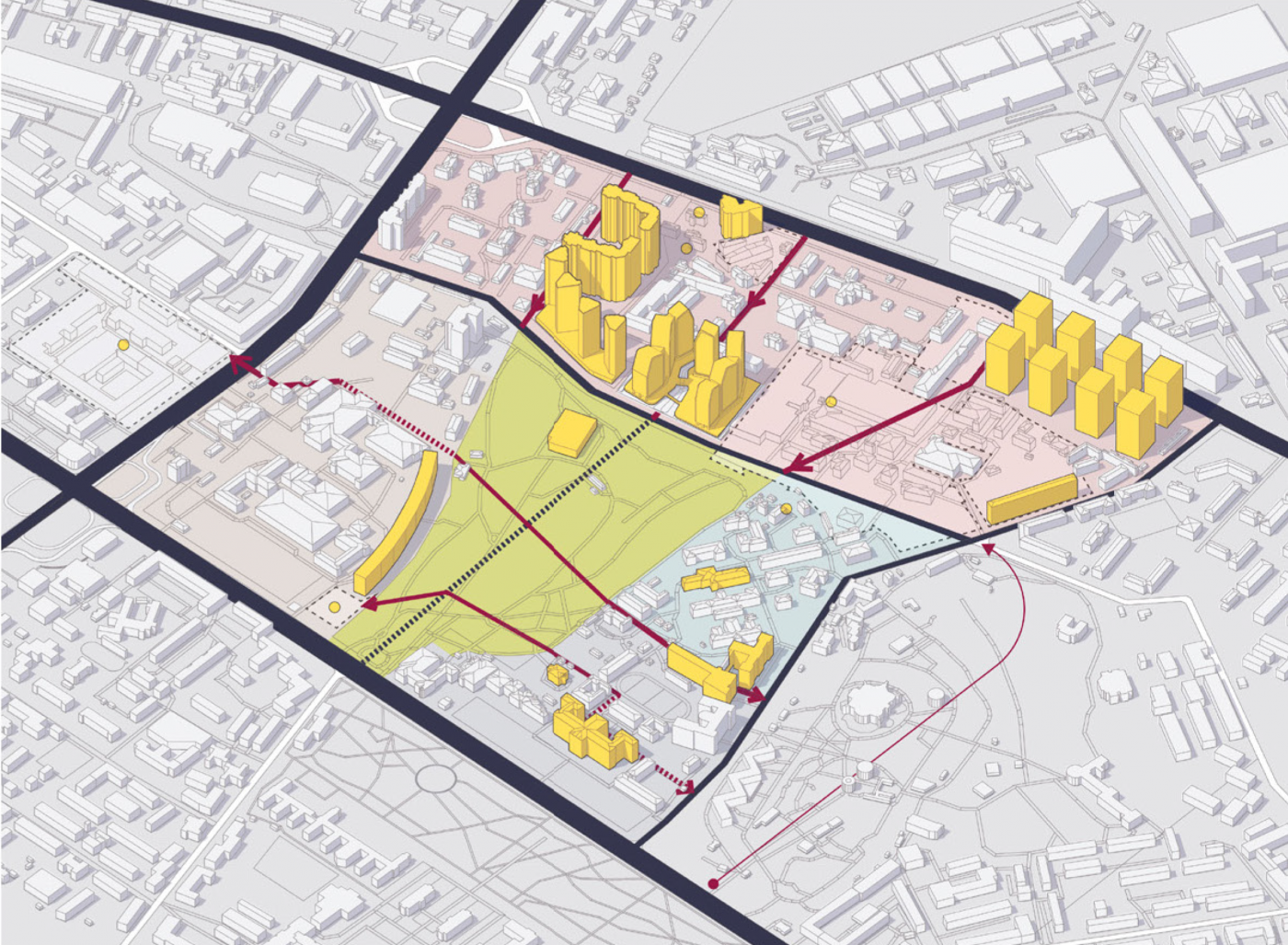
We suggest partitioning the large block into several smaller ones using a distinct grid of pedestrian connections. By creating a clear grid, we are simplifying the task of spatial orientation for people, improving their interaction with the city environment, making it more active.
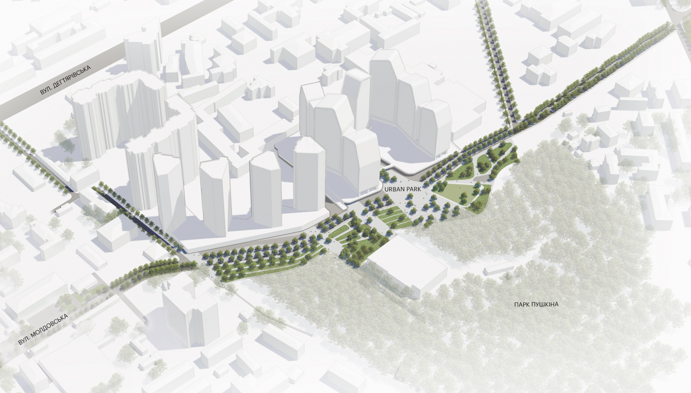
The segment of Moldovska street that borders the urban park is to be organized according to the principle of shared space. The S-shaped road motivates the drivers to slow down and to be more careful. All of this ensures pedestrian priority.
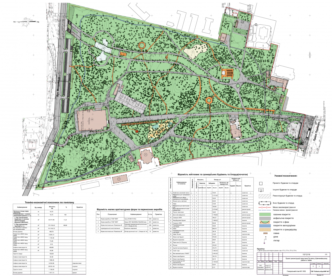
Changes await Pushkin Park as well. There is an already approved plan for the park’s reconstruction, developed by the Kyiv Parks Project and Kyivmiskbud-BMU (Construction and Installation Dept.) #1 Ltd.
We analyzed the project and noticed its weak points. Infrastructure is located inside the quiet zone, where it is not necessary. The amphitheater, the skate park, the sports and children’s playgrounds are dispersed throughout the territory and not connected to one another. A significant part of Moldovska street is taken up by a parking lot, while the entrance is planned on the side. The existing plan is chaotic and does not solve the problems of this area. It does not account for connections beyond the park and develops the park separately from the rest of the neighborhood.
The skate park and the basketball court cause noise pollution inside the park. Our recommendation is to conserve the quiet nature area and to move the activities closer to the street, creating an urban park in place of the buffer zone between the street and Pushkin Park.
In the space where the park borders the residential housing, we set up an urban park with a pedestrian promenade and a shared space.
Furthermore, this space must provide an entrance to Pushkin Park. Currently, the northern part of the park is a dead end, but, in the future, it is going to enhance the connections in the entire neighborhood and will be the main entrance to the park.
There are 8 functional zones formed within the territory. The placement of each zone depends on the location context, the flow of user traffic, and its intended use.
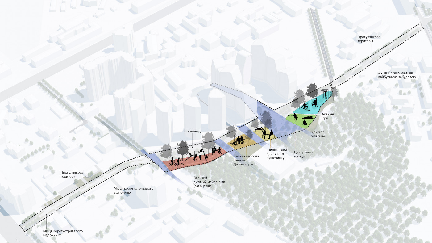
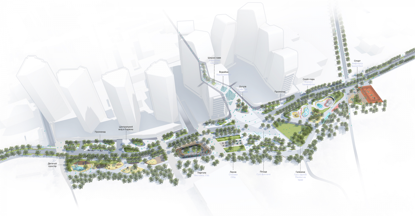
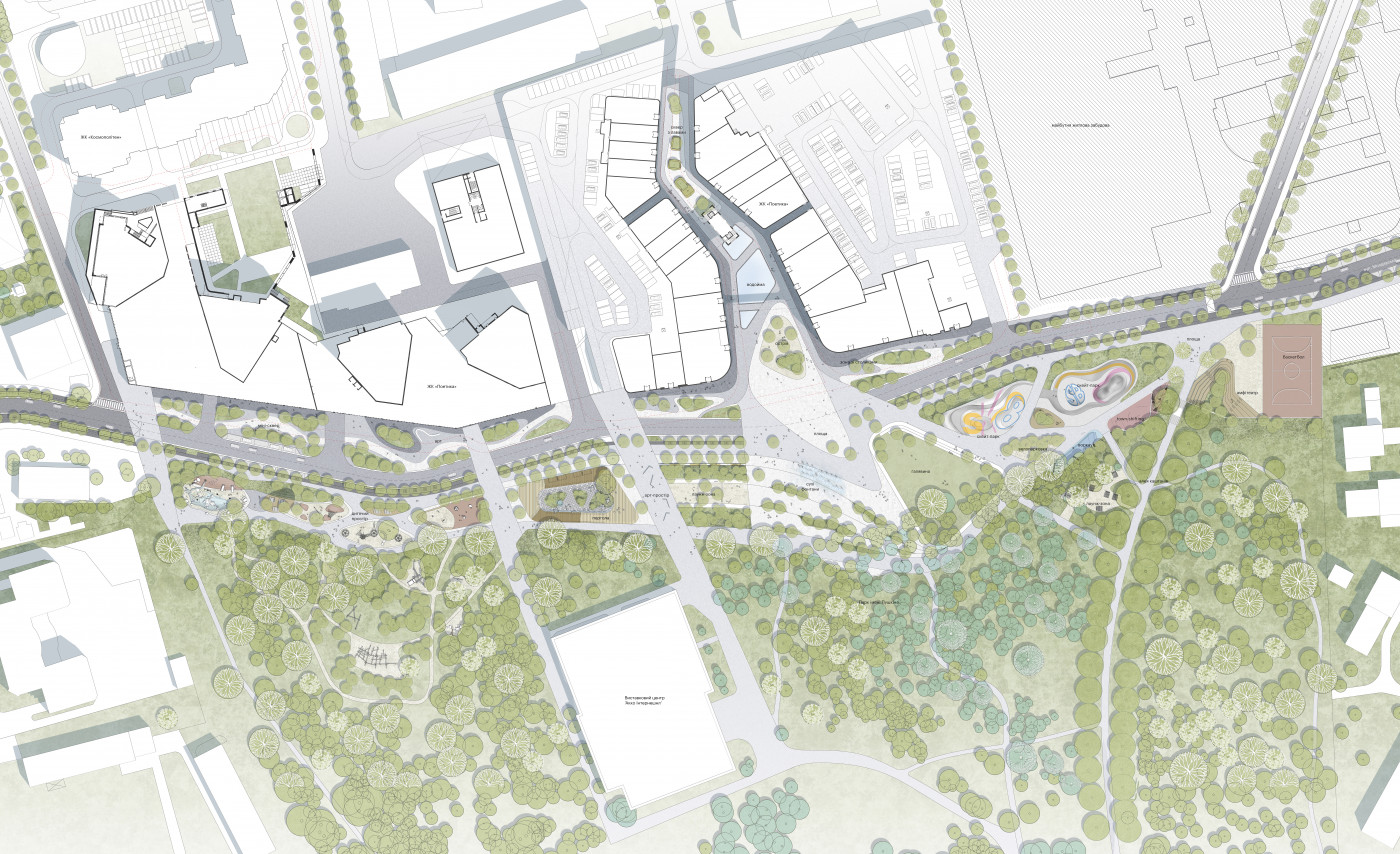
The urban feel and infrastructure complement the natural zone of the park. The entrance to the park is relocated to the central square of the promenade.
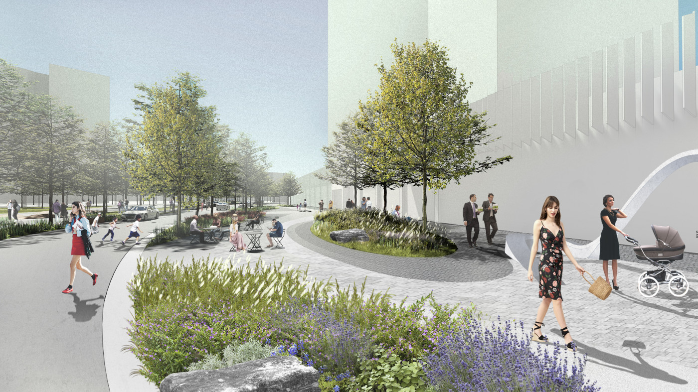
The promenade runs along the residential complexes and is a part of Moldovska street. Both, the pedestrian part and the road are winding. This makes it harder for their users to rush through quickly. Instead, they slow down and enjoy the park, relax, stop at the cafe and take a break.
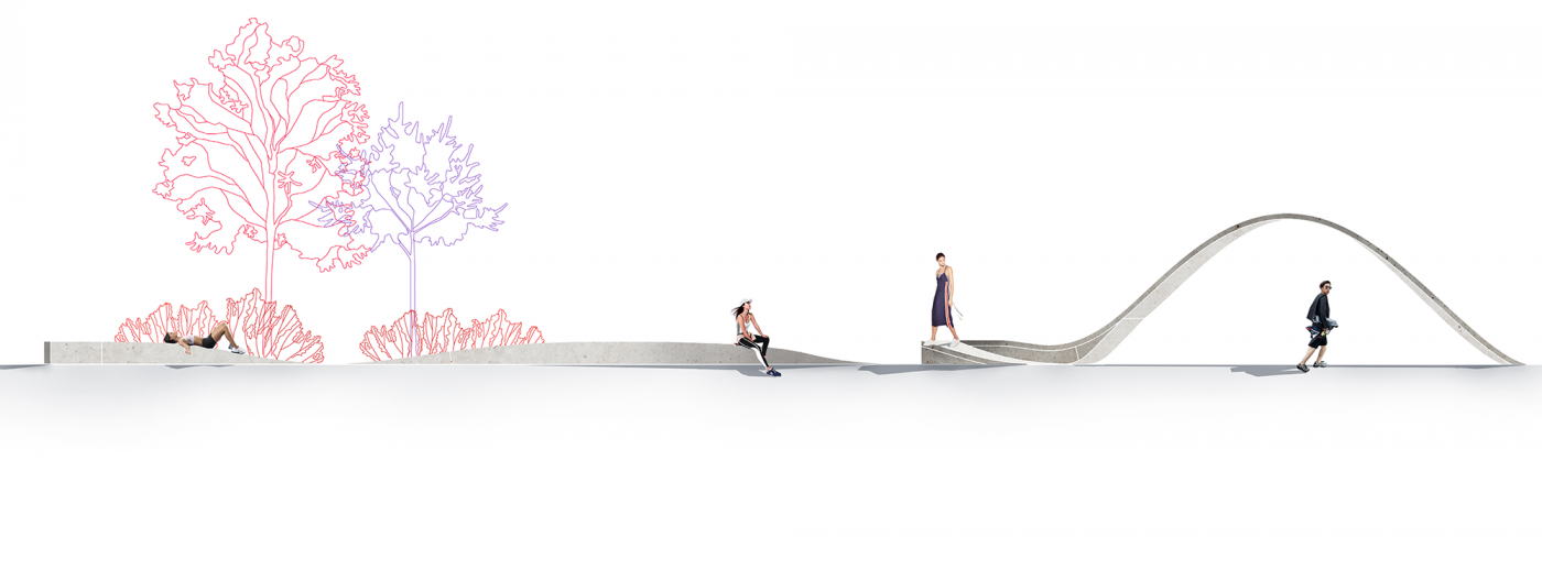
Art pieces help to mark the space. They accentuate the already existing shapes of the pathway without being the “main characters” of the territory. Three interactive art pieces are located within the promenade area. They can be used to walk on, to lay down upon, and to relax.
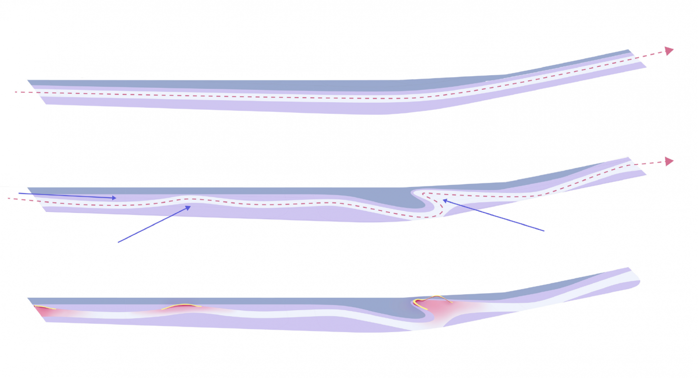
The first part has the simplest art element in the form of a straight line that has been raised on one side, which directs the visitors to keep going. The subsequent elements become more complicated in shape.
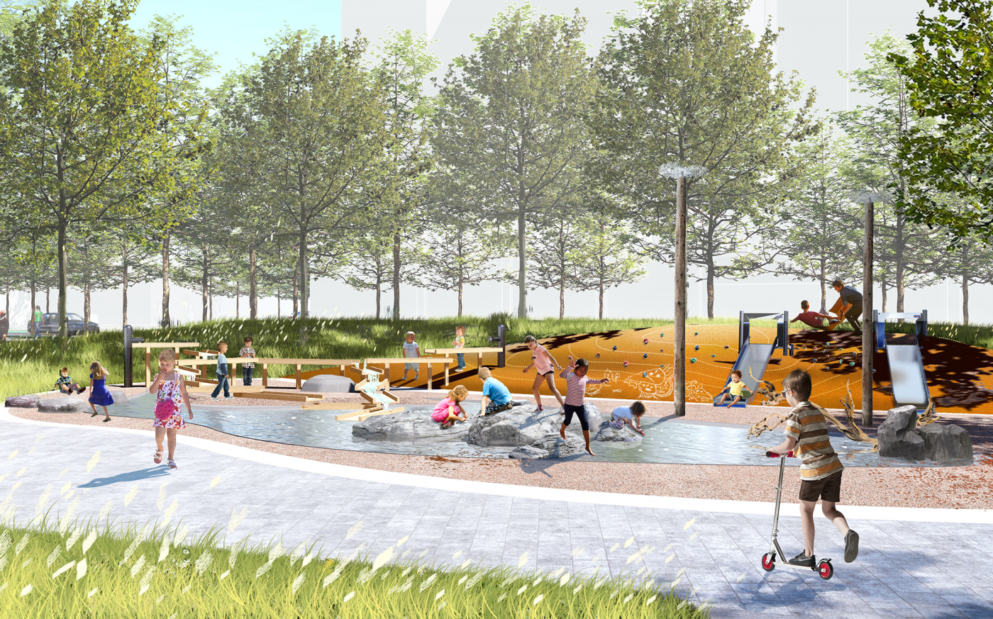
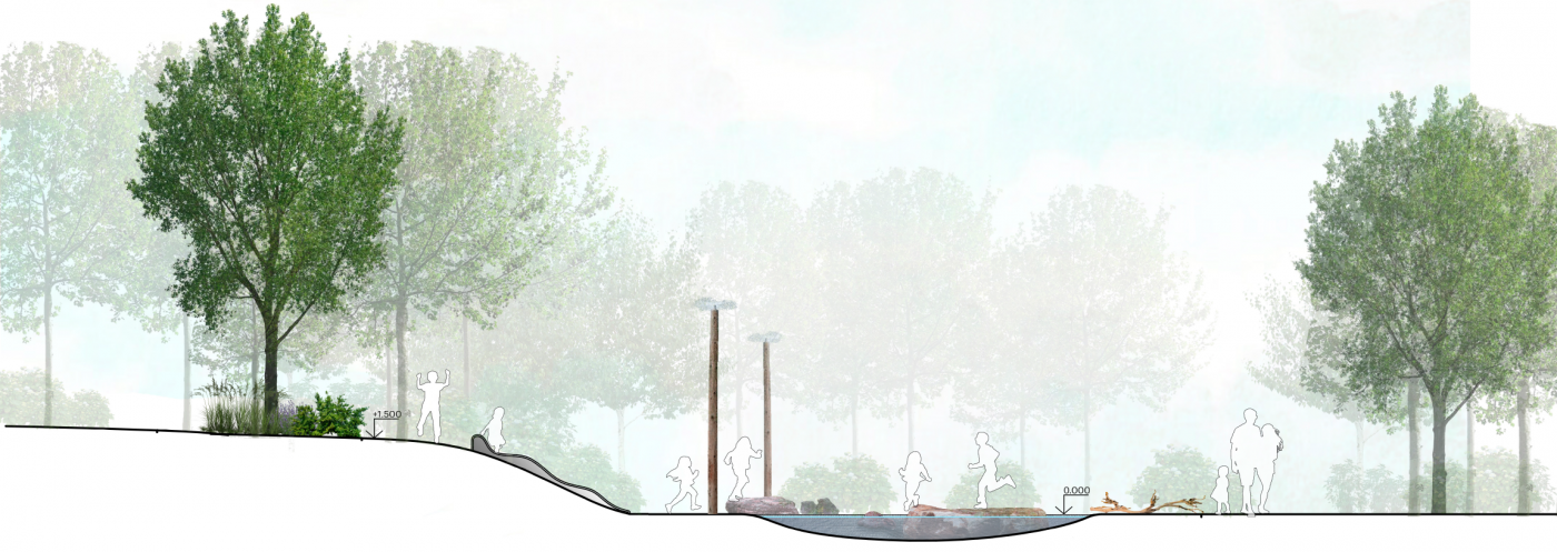
The children’s play area on the promenade will be important for the entire newly created district and park. It is separated from the road by terrain and is comprised of 4 playgrounds and 2 zones for parents.
The first playground is for games with water, the second—hills and climbing elements. The third playground is the largest one and allows for the most active play—it is a play complex for older children. The sandbox for the youngest children is located closer to the walkway.
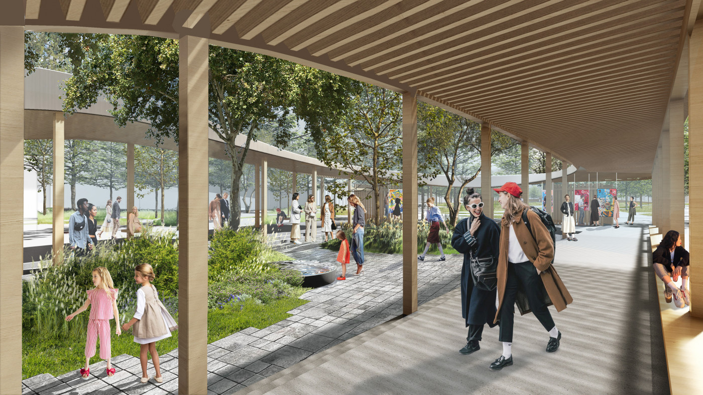
The pergola is a logical extension of the Exhibition Center that located in the park. It a great space for pre- and after partying when art events are taking place at the square. Its walls can be used for art exhibitions.
The urban park square is the largest pedestrian area, as well as the entrance to Pushkin Park, and the element that connects the park to Dehtiarivska street.
Here, the visitors can have a good time at parties, participate in art festivals, watch events while sitting on the lawn and talking to friends.
All squares (both large and small) can be used to conduct art events. If the events are large, they can extend from the square onto the green lawn, where the guests can watch the action from the sidelines and talk to their friends in a quieter environment. The lawn is a continuation of the square, and it complements the park, which lacks just this type of open space.
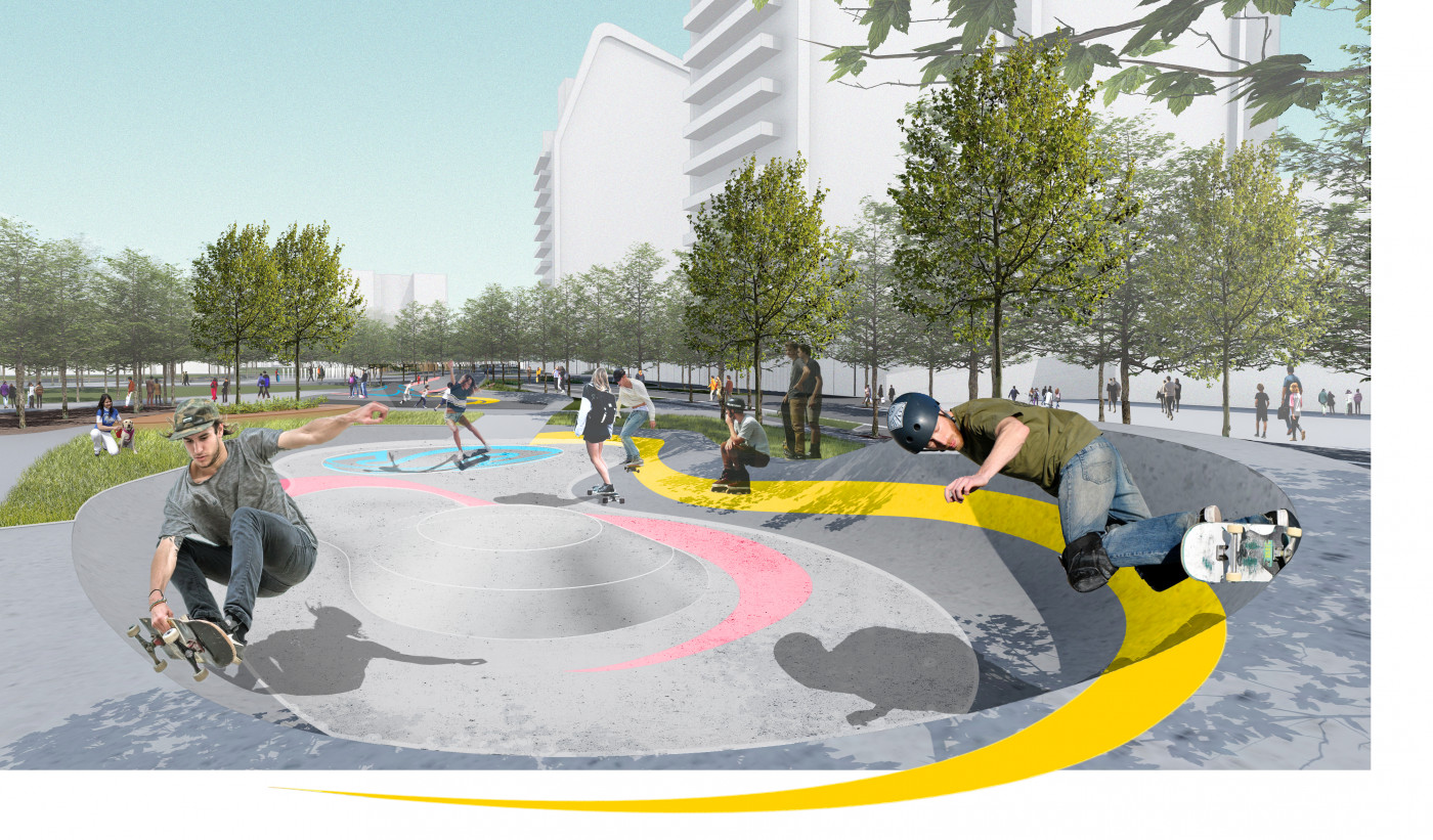
The skate park is comprised of two parts. The first part is intended for younger children (approximately up to 10 years old), its surface is marked with “SK8” (encoded word “skate”). The more advanced part of the park is marked with “SB” (abbreviation for “skateboard”) and is intended for young people.
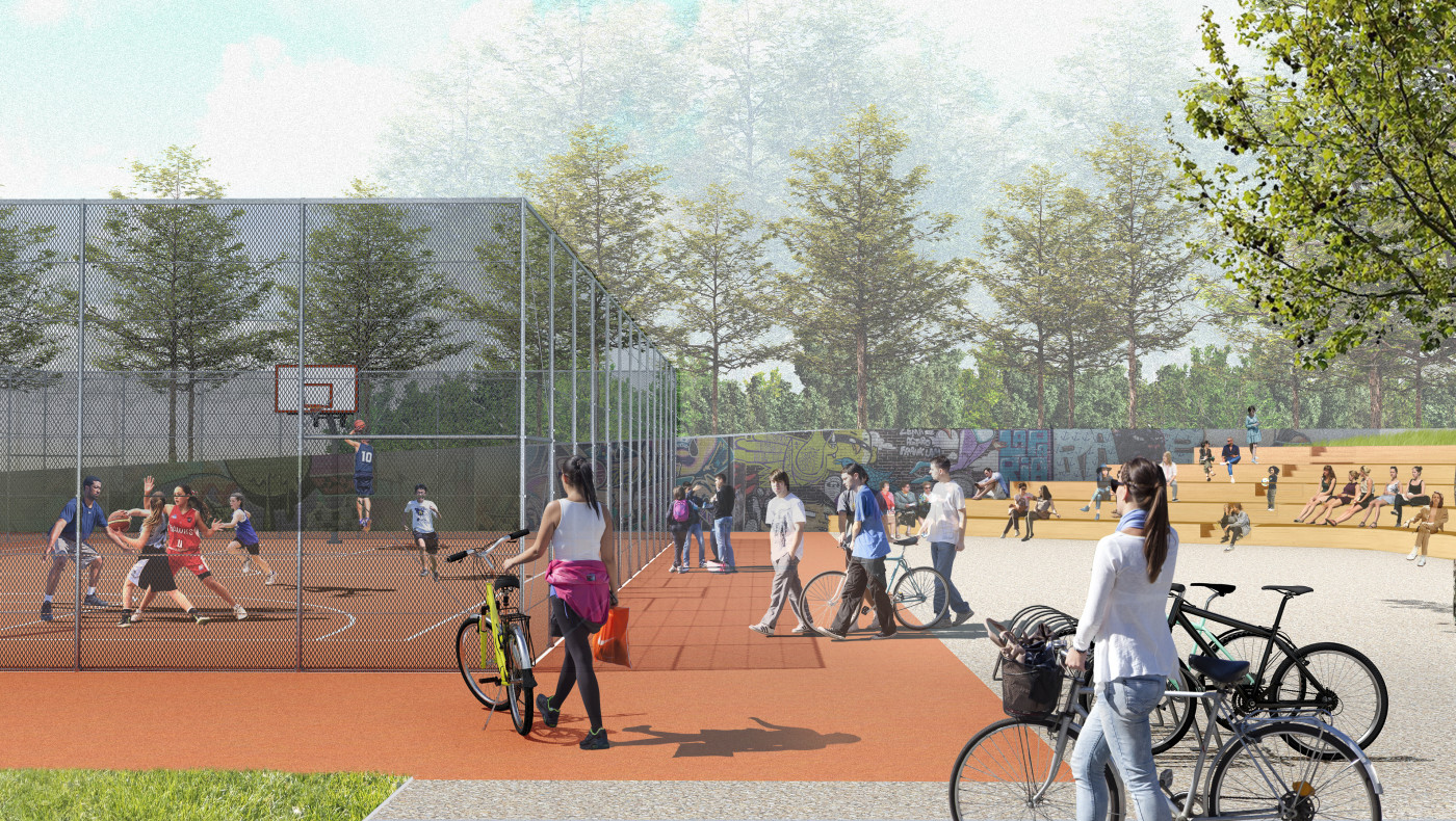
The basketball court is located here. There is a 3-meter difference in terrain elevation, which we used to incorporate the sports zone, turning the descent into an amphitheater that can be used to watch games.
This makes sport visible and accessible, which motivates the people walking by to lead an athletic lifestyle.
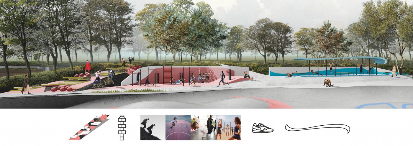
Stairs and a ramp lead up to the sports grounds. A third, alternative route is the townshifting path, built as a game.
Townshifting (town + shifting = moving around town) is a city attraction, created in collaboration with Commercial Public Art.
Instead of simply going up or down, one can walk on different types of surfaces (wood, rubber, concrete), play with the geometric forms built into the pathway. The rubber surface, the wooden blocks, the anti-parking spheres—all of them create a city micro route, providing an overall unique experience.
Landscape architecture studio 'KOTSIUBA'
Maksym Kotsiuba, Mariia Andriienko, Svitlana Konopliova, Marianna Kryvoruchko, Inna Dobrovolska, Andriy Kunitsky
Strategy + design — Other Land
Web development — Perevorot.com